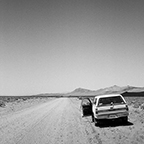
Library of Approximate Location
The Library of Approximate Location is an ongoing itinerant project installing site-specific, small scale libraries at selected locations around the American West. Taking as its starting point the often terrible reality of this landscape as a vast, techno-industrial megastructure, this library proposes alternative networks, supply chains, resource management practices. What might happen if we diversify our value systems to reflect family histories, emotional landscapes, indigenous sovereignty, or an aesthetic of the commons? Operating on an alternative logic, and claiming physical space for sharing and non-monetized transaction, the library becomes the ideal site to speculate critically about restructuring the terms of exchange around resource extraction and a networked world.
* * *
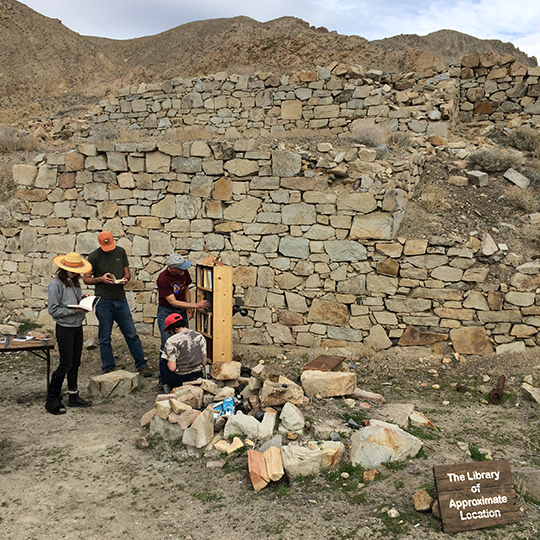
Bravo 20
- NP2016-002.01--LI
- February, 2016
- Carson Sink, Nev.
- 39°50'58.1"N 118°13'07.0"W
- Numa (Northern Paiute) Territory
- library catalog unavailable
. . .
Installed on the edge of the Carson Sink, at the site of Coppereid, this library installation was dedicated to consideration of Bravo 20 — a US navy bombing range with a surprisingly lively history. The Navy began bombing the land, which is a Northern Paiute sacred site, without formally withdrawing or cordoning off the area in any way. As grassroots opposition to military land use in Nevada grew, the bombing range itself became a central location for the struggle, and it was eventually occupied by environmental, tribal, and aeronautical activists (the Navy also wanted to close local airspace) activists who forced the Navy to shutdown the range for more than a year. Today, bombing has resumed but Bravo 20 remains an ideal site to examine the stratigraphy of the anthropocene and its malcontents — characterized equally equally as sacred site, utopian dream, target of violence, landscape of industrial technology, and region of resource extraction. The Library installation also included a guided walk to the fence at the edge of the bombing range, where the Librarian led participants in the completetion of several guided reading exercises.
Notable Holes (2016)
- NH2016-001.01--CA
- October, 2016
- Mono County, Calif. to San Bernardino County, Calif.
- various coordinates, esp: 35°37'11.6"N 117°22'01.8"W.
- Nuwa (Kawaiisu) and Newe (Western Shoshone) Territory
- Library catalog unavailable
- Collaboration with Alison Jean Cole
. . .
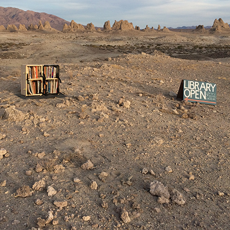
The first installment of Notable Holes of the Western United States, this project was a speculative, conceptual research tour in which we visited sites of opening across the landscape of western Nevada and eastern California. Lasting 6 days, from October 3 to October 9, 2016, this endeavor brought us to all manner of mines, craters, caves, springs, valleys, fissures, tunnels, sumps, adits, and pits, as well as various other conceptual openings which manifest physically into sites of interest in this strange, wonderful, and essential landscape. The tour included stops at the Mono Craters, the outlet of the first LA Aqueduct Tunnel, Little Hot Creek hot springs, Fish Lake Valley hot well, Coyote Hole, Silver Lake lithium mines, International Car Forest of the Last Church, the Hard Luck Mine and Castle, Searles Lake, and more. This tour was part of ongoing research into landscapes of extraction and aesthetics of excavation and absence in the American West, and comprises a piece and a beginning in our collective efforts to better understand the dynamics of these (post-eco)systems and economies. The Library of Approx. Location was brought along and installed to inform participants along the way.
Crystal Geyser / Green River Missile Range
- LI2017-001.01--UT
- May, 2017
- Green River, Utah
- 38°56'18.3"N 110°08'06.7"W and 38°58'24.5"N 110°06'46.5"W
- Núu-agha-tʉvʉ-pʉ̱ (Ute) Territory
- Library Catalog: here
- Supported by Epicenter
. . .
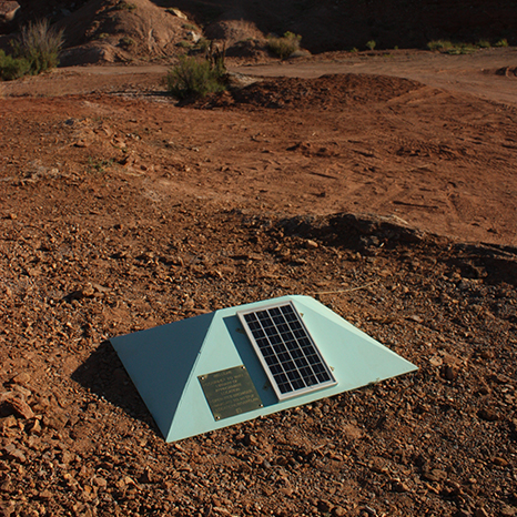
This installation was collected and conceived throughout the months of April and May 2017, as part of a Frontier Fellowship at Epicenter in Green River, Utah. Library materials were collected by wandering around town and talking to people, driving dirt roads and wondering, and even just clicking around on the internet. The messy, sometimes insignificant, non-linear, and difficult to digest library collection is intended to mirror the murkiness of place, and suggest the ways that documentation, prioritized over narrative, might begin to do this justice. This installation became two digital libraries, one of which was installed at the Crystal Geyser along the Green River, and one of which was installed outside magazine no. 2 of the abandoned Green River Launch Facility.
World Wide West (2017)
- LI2017-002.01--CA
- July, 2017
- Windy Hollow Rd, Point Arena, Calif.
- 38°55'18.7"N 123°42'03.0"W
- Bo-Ya (Central Coast Pomo) Territory
- Library catalog unavailable
- Supported by World Wide West
. . .
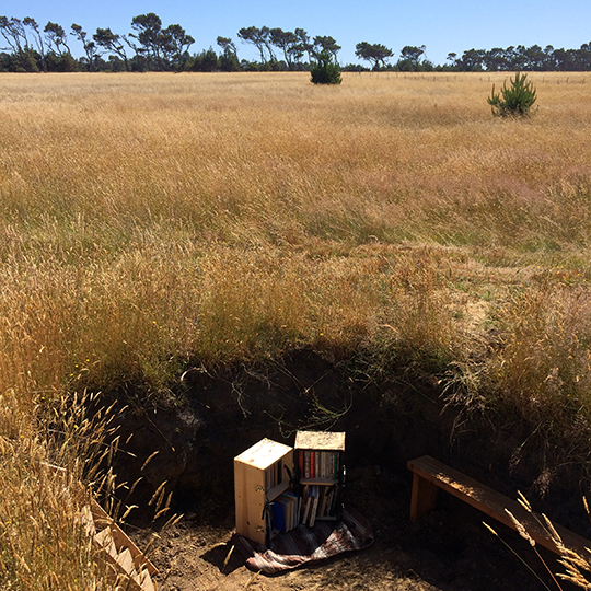
The second time the Library of Approx. Location was installed at the World Wide West summit, this installation was located in a hole specially finished for the occasion by collaborators at This Will Take Time. The installation included a small collection of physical materials meant to frame the place, landscape, and region of Point Arena in the larger context of resource use, media futures, and ruin. World Wide West, convened in Point Arena to examine the ways in which networks and technologies interact with/run through/pass under/jaunt across rural landscapes (a key trans-pacific internet cable landing is in near-by Manchester), was an opportunity for artists, writers, practitioners, and thinkers at the boundaries of media art, landscape, and information future, and the Library supported that mission.
Reno Lit Crawl
- LI2018-001.01--NV
- September, 2018
- Reno, Nev.
- 39°31'12.4"N 119°48'37.2"W
- Wašiw (Washo) Territory
- Library Catalog: here
- Supported by Nevada Humanities Literary Crawl
. . .
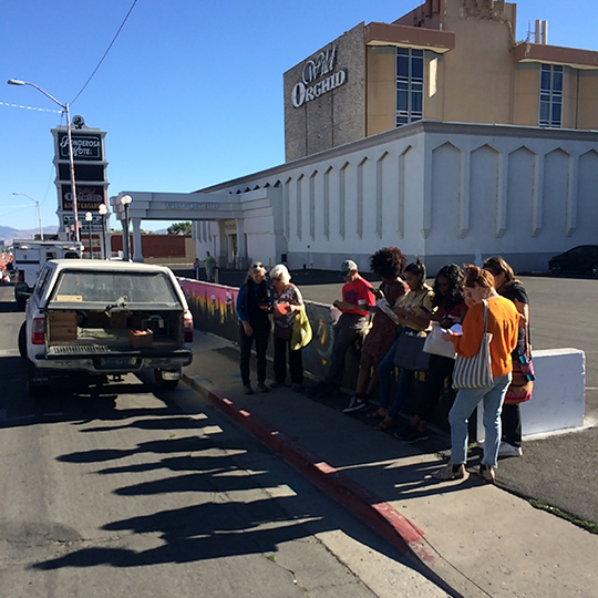
Building on the poem, "A Ritual to Read to Each Other" by William Stafford, this library was intended to explore what it means to live in Nevada and facilitate the sharing of those lived experiences. The library was installed as part of the Nevada Humanities Literary Crawl, and contained curated collections of digital library books and other readings around four different topics which have become part of the Nevada's narrative: Mining, Sex Work, Indigenous Sovereignty, and Water. Through reading to each other we become better practiced in the central lesson of Stafford's poem: "the signals we give -- yes or no, or maybe -- should be clear: the darkness around us is deep."
Museum of Capitalism
- LI2017-003.01--MOC
- July, 2017
- Oakland, Calif.
- 37°47'37.1"N 122°16'25.3"W
- Chochenyo and Mukwema Ohlone Territory
- Library catalog unavailable
- Collaboration with the Museum of Capitalism
. . .
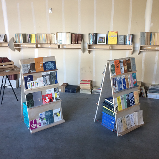
This installation of the Library of Approx. Location was compiled to be included as a reference collection for the Museum of Capitalism, a temporary museum installed in Jack London Square in Oakland, Calif. Coordinated by the artist collective FICTILIS, the Museum of Capitalism explored and interpreted the history and legacy of now-dead (mostly American) capitalism through artist projects and related work. The Library collection contained materials which spoke to that history and those projects. The Library also went on to be installed at the CASH Conference on universal basic income as an extension of the museum mission.

Notable Holes (2017)
- NH2017-001.01--CA-NV
- October, 2017
- Churchill County, Nev. to San Bernardino County, Calif.
- Various coordinates.
- Numa (Northern Paiute) and Newe (Western Shoshone) Territory
- Library Catalog: here
- Collaboration with Alison Jean Cole
. . .
The second installment of Notable Holes of the Western United States: a speculative, conceptual research tour in which we visited sites of opening across the landscape of western Nevada and eastern California. Similar to the first we sought out all manner of mines, craters, caves, springs, valleys, fissures, tunnels, sumps, adits, and pits, as well as various other conceptual openings which manifest physically into sites of interest in this strange, wonderful, and essential landscape. This tour included stops at the Project Shoal site, the Fairview Peak earthquake faults, the Kaiser purple fluorite mine, Diana's Punch Bowl, Belmont, Lunar Crater/Lunar Lake, the Little A'Le'Inn, Double Negative, China Date Ranch, Tecopa Hot Springs, Searles Lake, and more. The Library was brought along in digital form, tied to the power supply of the pickup truck to regulate possible usage hours of digital technologies during the tour.
COMMON SOURCE
- LI2017-004.01--PT
- March, 2017
- San Francisco, Calif.
- 37°47'08.2"N 122°24'08.6"W
- Yelamu Ohlone Territory
- Library catalog unavailable
- Presented with Nicole Lavelle as PLACE TALKS and supported by Yerba Buena Center for the Arts
photo by Miles Mattison
. . .
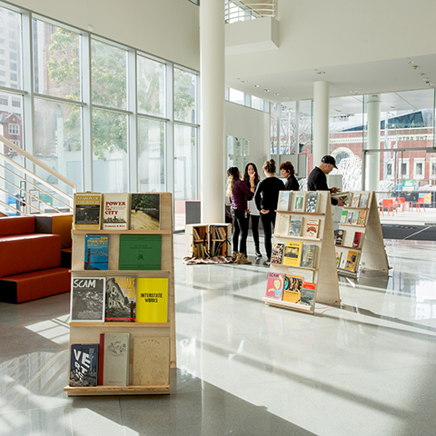
This installation was not the Library of Approx. Location, but a Library nonetheless. COMMON SOURCE was an installation of PLACE TALKS, compiled and installed with Nicole Lavelle, at Yerba Buena Center for the Arts. The installation, which included a library to browse, a selection of printed material to assemble as a take-home packet, and a soapbox from which participants were invited to read to the assembled crowd, was intended to consider the sharing of space alongside the sharing of information in a city where both are subject to privatization and enclosure by the highest bidder. This project intends to model what it might look like to engage the modest rituals of sharing over the grand ones of profit, construction, production.

World Wide West (2017)
- CP2016-001.01--LI
- July, 2016
- Windy Hollow Rd, Point Arena, Calif.
- 38°55'07.7"N 123°42'02.2"W
- Bo-Ya (Central Coast Pomo) Territory
- Library catalog unavailable
- Supported by World Wide West
. . .
The first time the Library of Approx. Location was installed at the World Wide West summit at This Will Take Time, this installation consisted of several elements: a hole, locally known as "library hole," dug specially Library staff for the occasion; a library collection and installation furniture; and an Environmental Impact Statement for the project complete with requisite ongoing site monitoring to ensure that reclamation is achieved as desired. The Library collection installed was intended to serve the purpose of situating the summit participants in the landscape and region of Point Arena, and inform the work performed along the summit theme, which was "forecast." Reclamation work is ongoing.

Sierra Nevada College
- LI2017-005.01--SNC
- March, 2017
- Lake Tahoe, Nev.
- 39°14'35.8"N 119°56'21.1"W
- Wašiw (Washo) Territory
- Library Catalog: here
- Supported by Sierra Nevada College Interdisciplinary Arts MFA program and Poetry Center
. . .
This installation of the Library of Approx. Location was completed while in residence at Sierra Nevada College's arts program. Library staff waded through snow drifts while compiling an extensive collection of digital materials, media, and data to speak to the area of Incline Village and Lake Tahoe. The Library was installed in a specially-built structure which served as container for the physical books and digital equipment; an interpreteive sign reminiscent of US public lands infrastructure; and a bat box with space inside for bats to make a home. Library staff also gave an artists talk on the project and on their own ties to the region of Lake Tahoe, the Eastern Sierra, and Northern Nevada.
- Read an article in the student newspaper about this installations |
- Read an article in the Tahoe Weekly about this installation
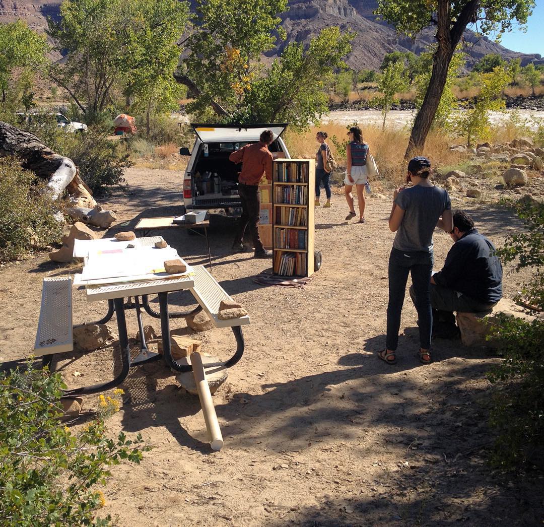
High Desert Test Sites: Epicenter
- LI2015-001.02--HDTS
- October, 2015
- Swayze's Beach, Utah
- 39°06'59.3"N 110°06'43.2"W
- Núu-agha-tʉvʉ-pʉ̱ (Ute) Territory
- Library catalog unavailable
- Supported by Epicenter and High Desert Test Sites
. . .
For the occasion of High Desert Test Sites: Epicenter, a collaborative curation of site-based artists' project, regional points of interest, and programs in and around rural Utah, the Library was installed next to the Green River near the bottom of Gray Canyon. Participants and visitors for High Desert Test Sites were invited to come and browse books, pamphlets, and maps about Green River and Southeast Utah, sit by the river, and drink coffee. Selected duplicate library books were also for sale in an artists' flea market for the occasion.
- Read a summary of the event from Epicenter |
Read a summary of the event from High Desert Test Sitebroken
* * *
